
Exploring the Benefits of Drone-Based Thermal Imaging


Introduction to Drone-Based Thermal Imaging
In recent years, the use of drones has expanded beyond recreational purposes to become invaluable tools in various industries. One of the most exciting applications is drone-based thermal imaging, which leverages infrared cameras mounted on drones to detect heat patterns. This technology is revolutionizing fields such as agriculture, construction, and emergency services by offering a bird's-eye view combined with thermal data.
Enhancing Agricultural Practices
Drone-based thermal imaging is proving to be a game-changer in agriculture. By capturing temperature variations across large fields, farmers can identify areas that need attention, such as regions affected by pests or disease. This technology enables precision agriculture, ensuring crops receive the right amount of water and nutrients, ultimately leading to increased yields and reduced waste.
Moreover, thermal imaging can help farmers monitor livestock health by detecting variations in body temperature. This proactive approach allows farmers to address health issues before they become severe, improving animal welfare and productivity.
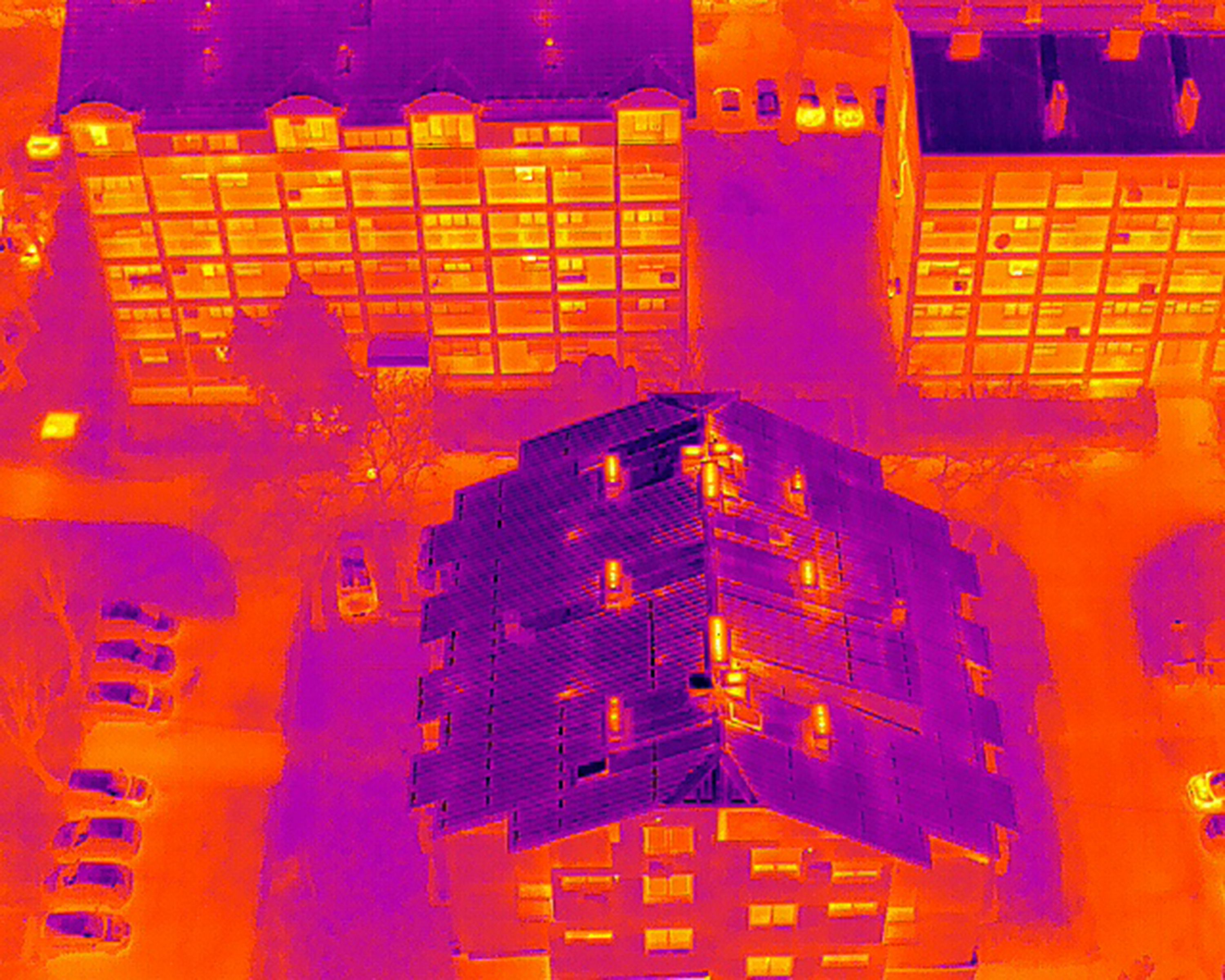
Improving Construction and Infrastructure Inspection
The construction industry benefits greatly from drone-based thermal imaging by ensuring the integrity and safety of structures. Drones can quickly survey large construction sites, identifying potential issues such as heat leaks or moisture accumulation in buildings. These inspections can be conducted without disrupting ongoing work, saving both time and resources.

Infrastructure maintenance also sees substantial benefits. Bridges, roads, and power lines can be inspected for wear and tear using thermal imaging, allowing for timely repairs and preventing costly failures. This proactive maintenance approach enhances the longevity and reliability of critical infrastructure.
Enhancing Public Safety and Emergency Response
Public safety agencies are increasingly adopting drone-based thermal imaging for emergency response. During search and rescue missions, drones equipped with thermal cameras can quickly locate individuals by detecting their heat signatures, even in challenging environments such as dense forests or at night.
Firefighters also utilize this technology to assess fire scenes, identifying hotspots and determining the safest paths for containment efforts. By providing real-time data, drone-based thermal imaging helps protect both emergency responders and the public.
Environmental Monitoring and Wildlife Conservation
Environmental scientists use drone-based thermal imaging to monitor ecosystems and wildlife populations. By detecting subtle changes in temperature, researchers can track animal movements and identify nesting sites without disturbing the natural habitat. This non-invasive method supports conservation efforts by providing valuable data to protect endangered species.
Additionally, thermal imaging helps in monitoring environmental changes such as deforestation or water quality, aiding in the development of strategies to combat environmental challenges effectively.
Future Prospects and Innovations
The potential of drone-based thermal imaging continues to grow as technology advances. Innovations such as improved sensor accuracy, extended flight times, and enhanced data processing capabilities are paving the way for even broader applications. Industries are recognizing the immense value of this technology in enhancing operational efficiency and sustainability.
As regulations evolve to accommodate these advancements, we can expect to see an increase in the adoption of drone-based thermal imaging across various sectors, further solidifying its role as a critical tool in modern industry practices.